Real projects, named and shown. Every deliverable below opened in a browser or a CAD tool the client already had.
Theatre · full 3D capture
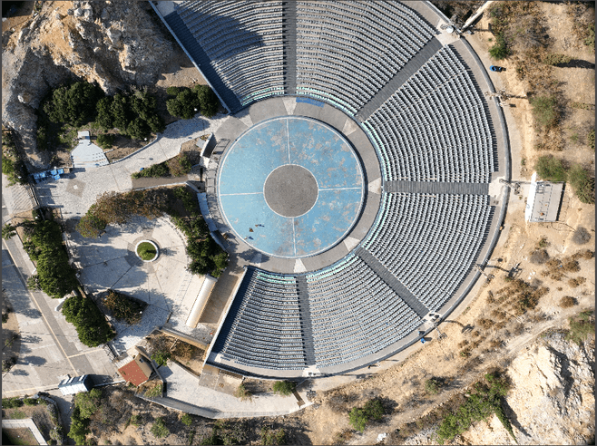
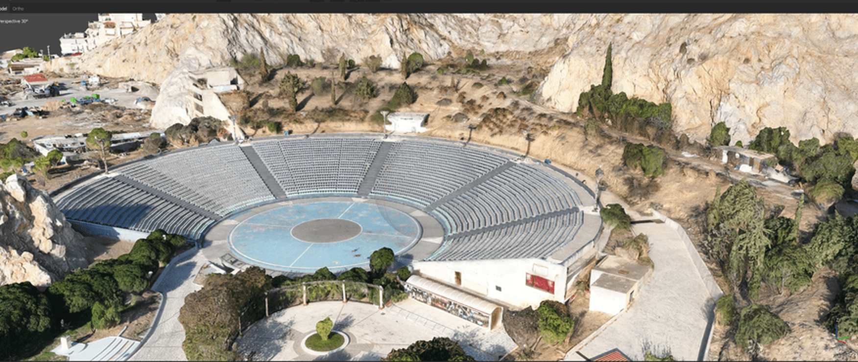
Katrakeio Theater
The problem
Document the open-air theatre as it stands, completely enough that architectural work could be planned against it.
Capture
RTK drone photogrammetry over the full structure and its surroundings.
Processing
Photogrammetric reconstruction to a point cloud, then a textured mesh.
Deliverables
Orthophoto of the theatre
Point cloud
Textured 3D mesh
Used for
Existing-condition documentation and architectural planning.
Heritage · documentation
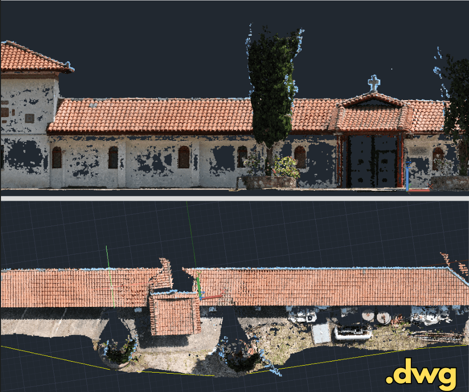
Monastery complex
The problem
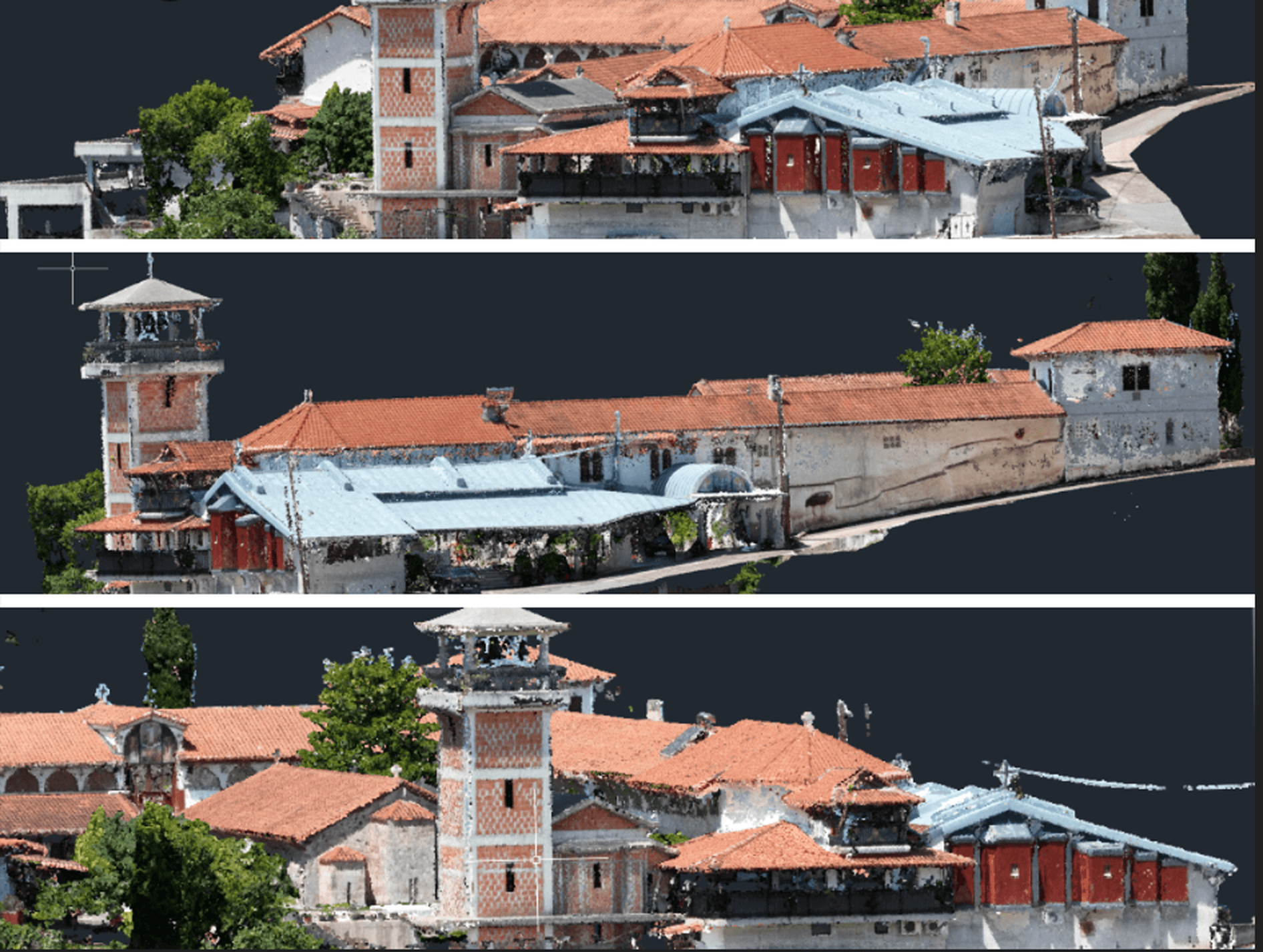
The restoration team needed elevations of a historic complex inside the CAD workflow they already had, not in a format they would have to learn.
Capture
Drone capture of the complex, planned around the elevations that had to be drawn.
Processing
Point-cloud reconstruction, then elevations extracted from the cloud.
Deliverables
Point-cloud elevations
Delivered as .dwg
Model views of the complex
Used for
Restoration planning and heritage documentation.
Land parcel · boundary survey
Land parcel
The problem
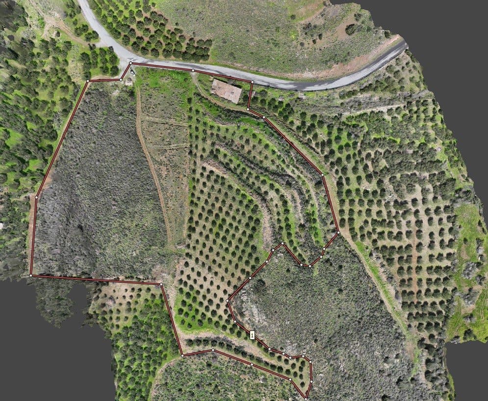
Measure a land parcel and its boundaries, from a single visit.
Capture
One drone flight over the parcel and its boundaries.
Processing
Photogrammetric processing, georeferenced to EGSA87 (GGRS87).
Deliverables
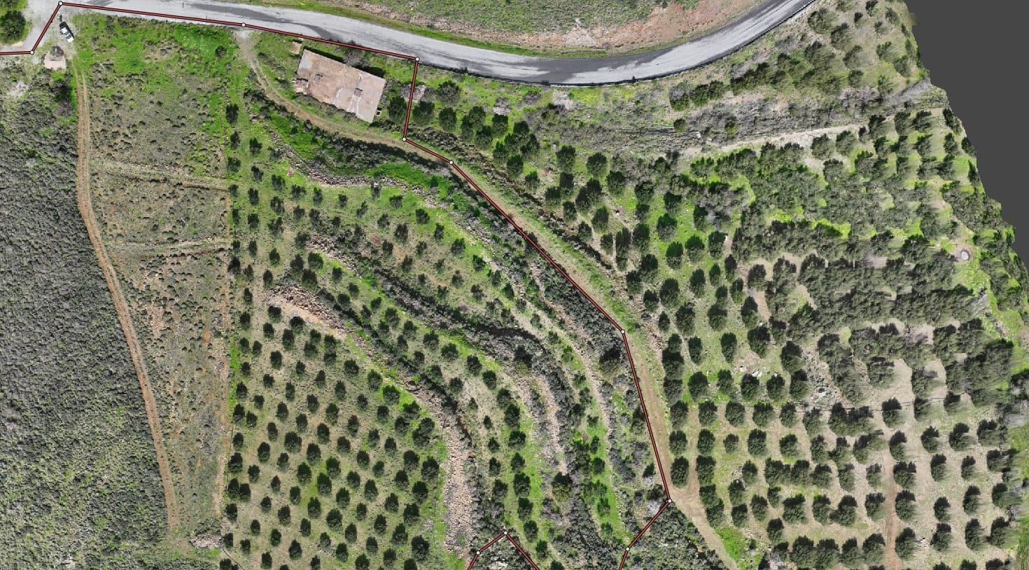
Orthophoto with the measured boundary
Measured parcel area
Georeferenced in EGSA87 (GGRS87)
Used for
Land transactions and planning.
EGSA87One flight
Try our models here, inside this page.
Four viewers written in-house, and our captures on Sketchfab. Some are sites we captured for clients, the rest we built ourselves to show that our process does not care what the subject is. Nothing to install, no licence to buy.