We turn real places into measurable digital twins.
Drone capture · 360° interior walkthroughs · photogrammetry · browser-based digital twins
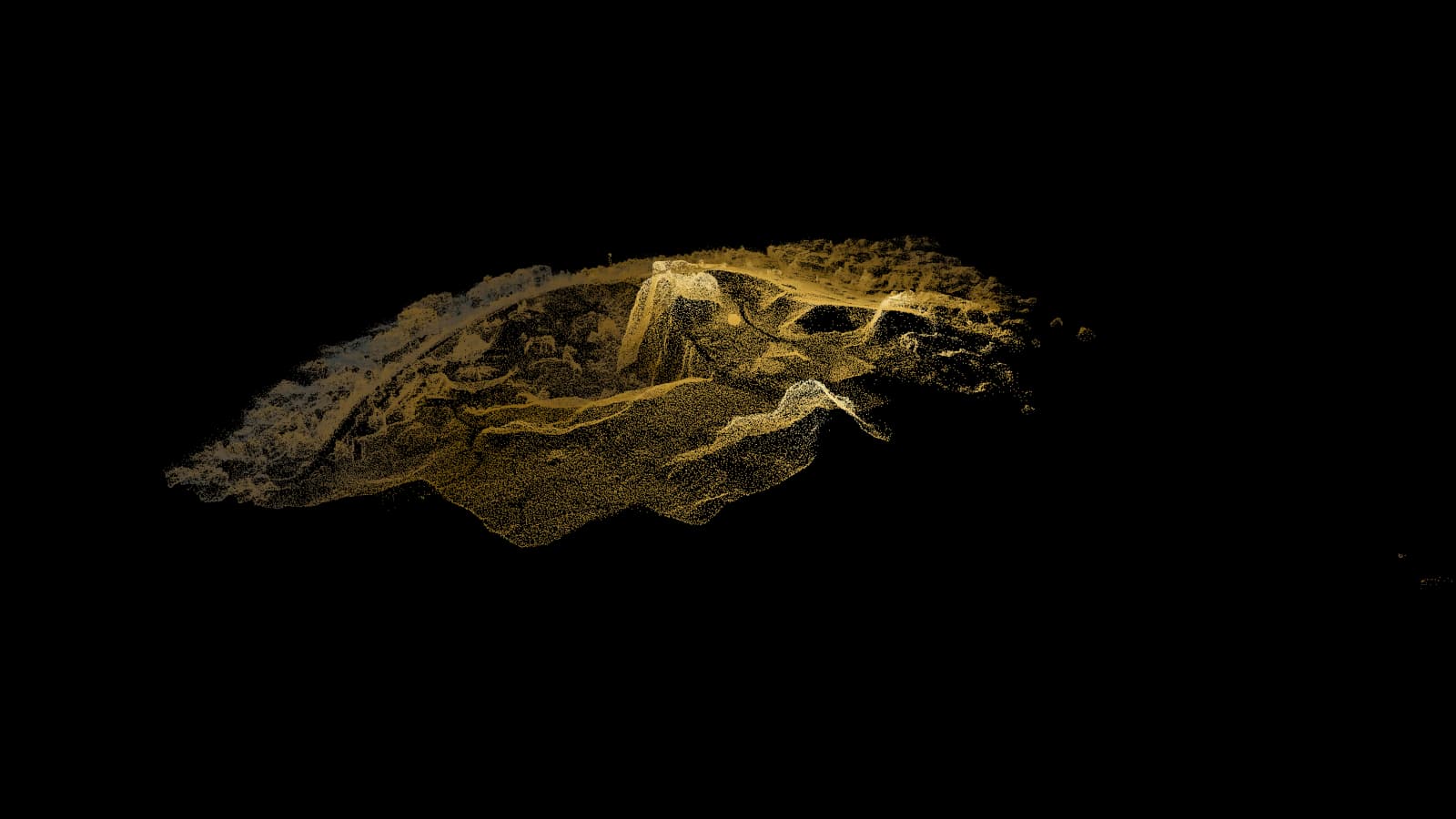
A real Aeromine capture: an open-pit quarry, 298,000 measured points
Most captures end up forgotten in a folder.
A drone survey records the geometry and the appearance of a site. Then what? It gets zipped, emailed once, and never opened again. Three reasons:
Opening the files can take specialist software.
Point clouds and meshes open in software the client, the site manager and the investor do not have and will not install.
A single capture does not show how the project changed.
One flight, one moment. Nothing links this month's reality to last month's.
The knowledge stays with one person.
Measurements, volumes and notes live in someone's project folder.
A capture is worth as much as the people who can open it.
One engine: capture, model, twin.
We fit the capture and the deliverables to what each project needs.
01
Capture
RTK drone flights for exteriors and terrain. 360° camera for interiors and walkthroughs. Planned overlap and ground control, so measurements taken on the model hold up.
02
Model
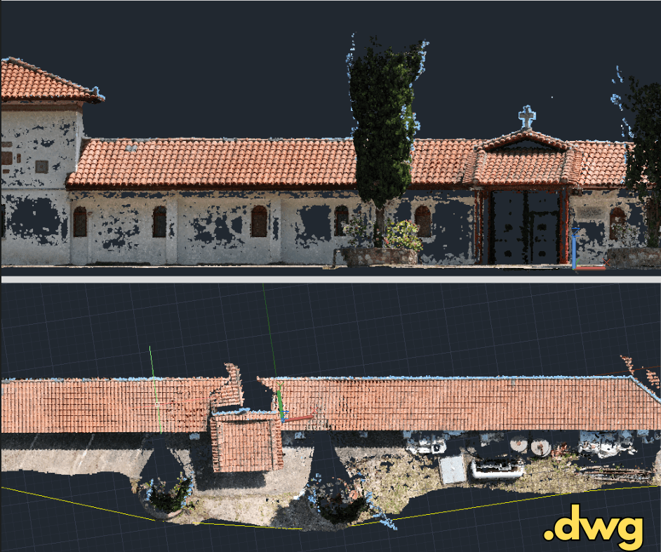
Photogrammetric processing to point cloud and textured mesh. Digital terrain models, contours, areas and volumes. Exports engineers already use: Revit, Civil 3D, AutoCAD, .dwg.
03
Twin
Opens in a browser: no download, no plugin, no licence. Information layers on top of geometry: keypoints, notes, measurements. Re-fly it and the twin gains a timeline instead of a replacement.
Deliverables open in the software you already have.
A deliverable is worth nothing if opening it needs a licence you do not own. Every export lands in a format your engineers already work in, and the twin needs no software at all.
Opens in
- AutoCAD
- Civil 3D
- Revit
- QGIS
- Web browser
Formats
- DWG
- DXF
- GeoTIFF
- LAS/LAZ
- E57
- OBJ
- GLTF/GLB
A 3D model is geometry. A digital twin is geometry that knows things.
| 3D model | Digital twin |
|---|---|
| Shape and texture | Shape, texture, and an information layer on top |
| Opens in specialist software | Opens in any browser, on any device |
| One moment in time | Every capture kept, so change is visible |
| Read it, and that is all | Measure it, annotate it, send it as a link |
Three services, one process behind them.
Each service stands on its own. Together they end at the same deliverable.
We work on any kind of site.
The sector does not change what we do. Only the deliverable does.
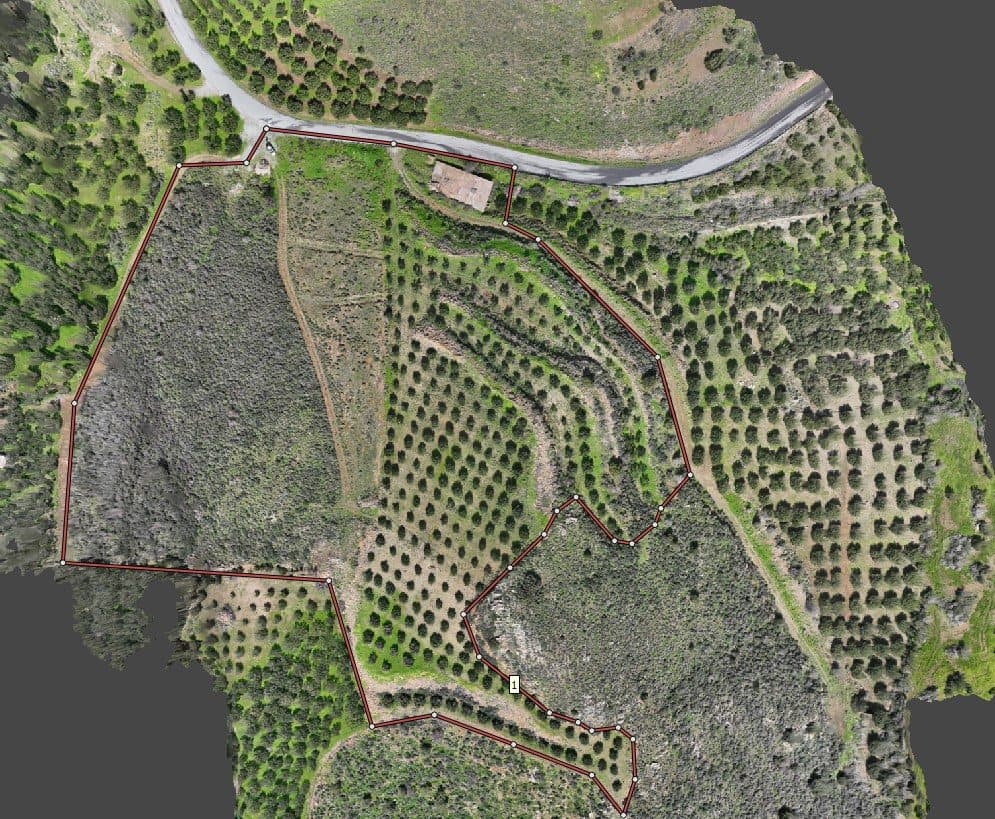
One of our real models, open to explore.
Lato quarry, captured by us and published as a browser twin. Drag to orbit, scroll to zoom, click the keypoints. Nothing to install, on any device you already own.
See every model →The project your client can actually log into.
Our own platform, built in-house. It closes the distance between the engineer and the client. Upload what you already have, photos, videos or PDFs, and your client sees the project progress in a browser.
More about AeroVIEW OS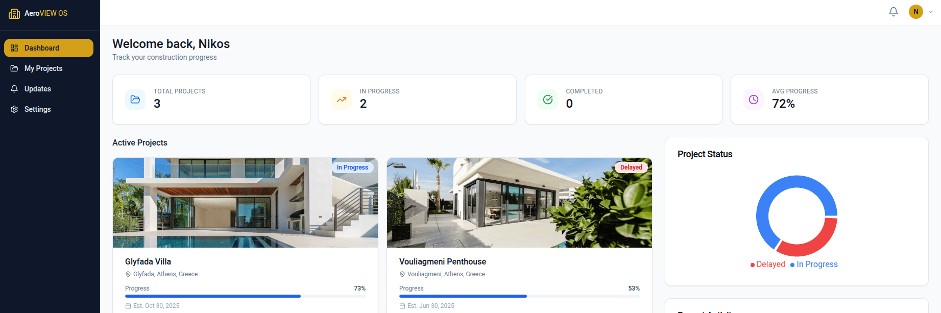
We own every step. That is why special requirements do not drive the price up.
We fly it.
In-house RTK drone operations and 360° capture. No subcontracted pilot, no scheduling chain.
We process it.
Agisoft Metashape, DJI Terra, Pix4D, Blender. Processing follows the plan and the accuracy target the capture was built around.
We build the viewer.
React, Three.js, React Three Fiber. AeroVIEW OS, a 3D mall map and standalone model viewers. All ours, all built in-house.
If it does not exist yet, we write it ourselves.
How we work
1
Scoping call.
You describe the site and what you need to measure. We tell you what is flyable and what is not.
2
Flight.
One visit. Drone exterior, 360° interior where it is needed, ground control where accuracy demands it.
3
Processing & delivery.
Point cloud, mesh, terrain model, volumes and plans, in the formats your engineers already open.
4
The twin goes live.
Your deliverable opens in a browser. Re-fly whenever you need, and the timeline builds itself.
Let's talk about your project.
Describe the site and what you need to measure. We tell you what is flyable and what is not.
Contact us